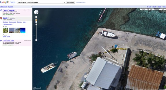
The kite-based imagery of places like BBQ Island and the Manihi atoll in French Polynesia is of much higher quality than the typical imagery on Google Maps, it's so detailed you can even see what kind of clothes people are wearing.
The process has some complications satellites don't have to worry about, though. "Due to the sun getting low in the sky, we weren't able to cover a large part of the village," Taylor said Monday of shots from Manihi atoll in French Polynesia now arriving in Google Maps. "There were telephone/electric poles and wires and trees in the village, so we had to avoid getting the kite string caught in those."
Source: CNET