Posted on Saturday, April 02 2011 @ 0:06 CEST by Thomas De Maesschalck
ESA has produced a detailed map of Earth's gravity, you can check it out
over here.
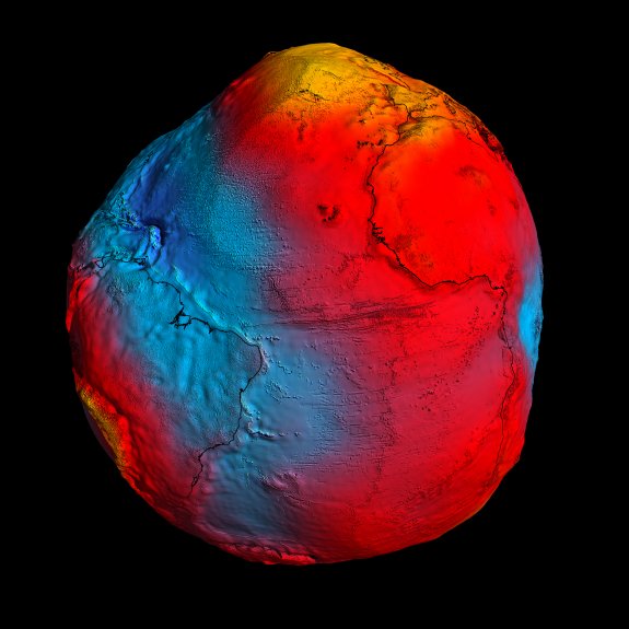
After just two years in orbit, ESA's GOCE satellite has gathered enough data to map Earth's gravity with unrivalled precision. Scientists now have access to the most accurate model of the 'geoid' ever produced to further our understanding of how Earth works.
The new geoid was unveiled today at the Fourth International GOCE User Workshop hosted at the Technische Universität München in Munich, Germany. Media representatives and scientists from around the world have been treated to the best view yet of global gravity.
The geoid is the surface of an ideal global ocean in the absence of tides and currents, shaped only by gravity. It is a crucial reference for measuring ocean circulation, sea-level change and ice dynamics – all affected by climate change.