Posted on Wednesday, July 06 2005 @ 19:34 CEST by Thomas De Maesschalck
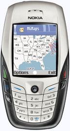
Someone released Mobile GMaps which is a free piece of software that displays Google Maps and Keyhole satellite imagery on devices that support Java J2ME such as some cell phones.
Mobile GMaps version 1.03 beta was released. For now, it fixes some bugs (locations with longitude or latitude between -1 and 0 degrees lost the minus when saved), and is ready to support map & satellite images as GIFs/JPEGs. This feature is not enabled yet, read this document for details.
It can be downloaded over at
Mobile GMaps